Cities Underwater:
Introduction
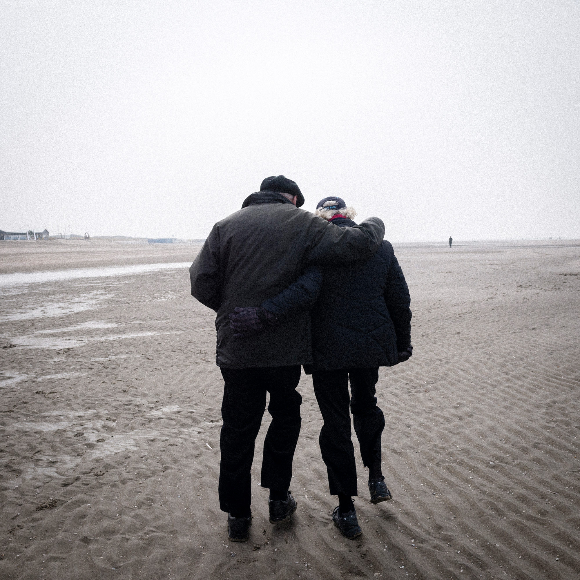
Imagine a world where nearly all our coastal cities are underwater. That’s what’s in store if climate change continues at its current pace, threatening to raise sea levels and create storm surges strong enough to drown out major metropolises and drive out half of the global population that now lives close to the water.
Sea levels are rising at an alarming rate, with projections for some coastal cities as high as 10 feet by the end of the century. Places like Rotterdam, Jakarta and Boston are not sitting idle. Cities Underwater is the first part of our series Living Proof: The Human Toll of Climate Change. In this reporting journey, we partnered with PRI’s The World and WGBH News for their series, Living with Rising Seas and Rising Tide: Boston Underwater.
Cities Underwater:
In Boston, 'No one wants their investment underwater'
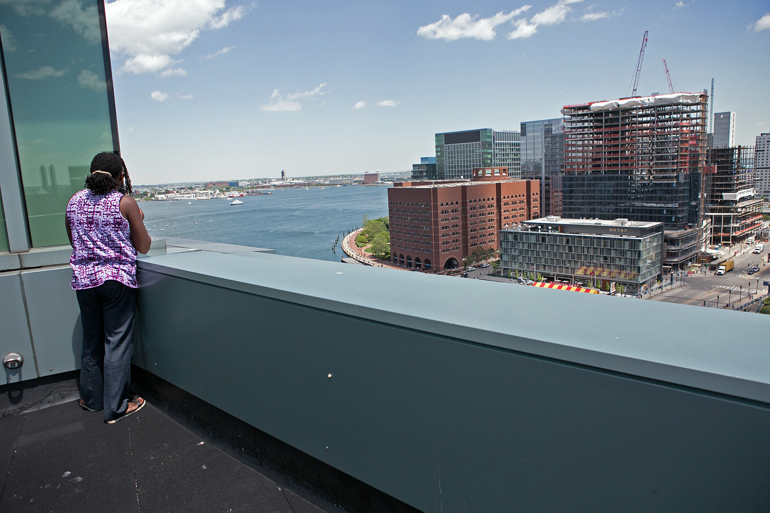
BOSTON — General Electric may be the latest big name to build on the Boston waterfront, but the corporate titan is one of many investors pouring money into land threatened by climate change.

There’s also a wave of money washing over the East Boston waterfront.
But here at 25 Lewis Street, soon to be one of the neighborhood’s biggest developments, it’s mostly just piles of rubble and decaying piers. Nearly one-third of Boston is made up of filled-in tidelands, and when a site is left alone for a while, the sea starts taking it back.
“Mother nature is reclaiming the site. You can see these seawalls are falling down, you can see the shoreline is eroding,” says Jamie Fay, founder and president of Fort Point Associates.
With developer Lendlease, Fay’s company is designing 400 apartments here called Clippership Wharf, named for the site’s origins as a shipyard. It’s been vacant for decades, but the site sports some remnants of its industrial past, including an old concrete seawall. Instead of restoring that seawall as it was, Fort Point Associates is doing something unusual: they’re pulling back, leaving what’s called a “living shoreline” with tide pools and salt marshes that will act as a buffer zone for sea level rise and storm surges.
“It’s still not going to be Cape Cod here,” says Fay, “but there will be a little piece of this project that people can look at and say, ‘OK, maybe this is what the shoreline of Boston Harbor used to look like.’”

Fay is thinking ahead, adapting this building—and its business proposition—to climate change. All along the harbor, you can see how developers are adjusting their buildings to the reality of coastal flooding. Next to Clippership is a building built about 10 years ago. Fay points out that its first occupied floor is raised about a foot off the ground. On the other side of the Clippership Wharf site is another building, just two years old, with its first residential floor raised about four feet. Clippership Wharf’s apartments will be another four feet higher than that.
“You can see from the early 2000s, it’s been going up and up,” says Fay.
These developers aren’t going “up and up” because of regulation. As far as climate change adaptation goes, City Hall only requires waterfront buildings to submit a checklist of things they’ve done to consider the impact of things like sea level rise and storm surge flooding. There’s no requirement that they act on it. But developers like Fay say no one wants their investment underwater.
Magdalena Ayed says no matter their motivation, developers need to build a neighborhood that’s resilient in the face of climate change. Ayed is a community organizer in East Boston. Recently updated federal maps of flood risk areas show that much of her neighborhood would be underwater during a big storm.
Ayed says she’s happy that city officials and some developers are starting to take this seriously – for the sake of her two young sons who are growing up here. She and her neighbors are working with the city to make sure climate change planning remains focused on protecting the city’s most vulnerable residents.
“We need help,” she says. “We need people to listen to what our concerns are, to come into this community and consider us local community experts and take that local community expertise and put it into the planning.”

It’s hard to know exactly how much is being spent, but Paul Kirshen, a professor of climate adaptation at UMass Boston, says right now we’re underinvesting. And the longer we wait, the more the fix is going to cost us.
“It would be a net expense. But if you compare it with the cost of doing nothing,” says Kirshen, “then the benefits of adaptation are huge.”
Each dollar spent adapting could yield $4 to $20 in economic return, he says. That could still mean spending billions of dollars for new development and additional infrastructure. But, Kirshen says, we’d be building a better city in the process.
But working neighborhood by neighborhood is complicated. It’s tempting to look for silver bullet solutions that would take care of the entire city, like a giant storm surge barrier spanning Boston Harbor. But Kirshen says those solutions are very expensive – and they rarely work.
It isn’t just a matter of mustering the political will to unlock piles of money.
“The trick about adaptation planning is not to under-invest or over-invest,” says Kirshen.

Adapting to climate change isn’t just about avoiding damage, says Kirshen. It can actually create new economic opportunities. There’s a historical parallel for this. In the 1980s, we started spending hundreds of millions of dollars to clean up Boston Harbor, and that laid the foundation for today’s harborfront real estate boom.
That lesson is not lost on City Hall. For years, officials have been working on Climate Ready Boston. Austin Blackmon – the city’s chief of environment, energy and open space – says it’ll be the city’s first comprehensive plan to deal with climate change.
“Climate Ready Boston is the Moneyball of climate analysis,” says Blackmon. “This is us using all the data available to make the most informed decisions to help us understand what the wisest investments are that are available to us.”
The city is also looking for help from abroad. Blackmon is part of a group of city officials and private business people traveling to Europe this week.
Their first stop is someplace that could teach them a lot about managing water: the Netherlands.

“In fact, the history of the Netherlands is the history of floods,” says Roeland Hillen, who runs the national flood defense program of the Netherlands. I met him on top of a dike outside Rotterdam, which was being reinforced as part of routine flood-control maintenance that costs the Dutch about a billion dollars each year.
“We built the dikes since the 12th century. Add after that we experience floods every now and then. And then the people rebuild the dike even higher and stronger than it was before. And so the flood – one after the other – kind of made up our history,” says Hillen.
And, Hillen says, the Netherlands is willing to share its expertise with us.
The Netherlands flood-proofed a whole country where more than a quarter of the population lives below sea level. They’re the ultimate example of spending money to save money. And they might have clues for how Boston can proactively deal with a changing climate.


Cities Underwater:
As sea levels rise, Rotterdam floats to the top
ROTTERDAM, Netherlands — When a big storm hits a coastal city like New York or New Orleans, it’s often the storm surge that does the most damage – the rising water that comes with low atmospheric pressure. But when the next big one hits Rotterdam, the Maeslant storm surge barrier will be ready for it.

The Maeslant structure is the largest mobile barrier in the world — picture a pair of steel lattices twice the size of the Eiffel Tower, lying down on either side of the channel connecting the Netherlands’ second-biggest city to the North Sea. The Dutch built the massive gate in the 1990s to protect Rotterdam from a storm surge of up to three meters.
That was back when much of the world still saw climate change and sea level rise as distant threats. But not the Dutch.
“We were already busy with the climate change before it was worldwide,” says Peter Persoon, an engineer turned tour guide at the barrier. “What we are busy with is the future. What are the circumstances in 2100? That’s why we are preparing our country.”
It’s also why cities around the world are turning to the Dutch for their expertise in living with water, honed over generations.
Persoon says the Maeslant barrier should protect Rotterdam from everything up to a one-in-10,000-year storm. Compare that to the levees protecting New Orleans before Hurricane Katrina, which were built for a one-in-100-year event. It cost more than $500 million — a big sum but just a small slice of what the country is investing to fight the effects of climate change.
And Persoon says it’s money well-spent. The Maeslant barrier has already had to be closed once, in 2007. And sea level rise projections suggest it could be closing a lot more often in the coming decades.
“What we tell the people here in the Netherlands is, if the country is flooded the damage will be at least 700 billion euros,” Persoon says. “If you instead spend every year one billion euros, you spread the bill over 700 years. That’s, I think, the Dutch way.”
That “Dutch way” goes back hundreds of years. Most of the country’s people live less than a meter above sea level, or even below it. The modern Dutch government actually grew out of medieval “water boards” that managed the windmills and canals that have long helped keep the low-lying country dry.
But in the 21st century it’s a challenge on a whole different scale. And you can see the Dutch taking it on just about wherever you look.
About 30 miles west of downtown Rotterdam, where the Rhine River empties into The North Sea, more than 10,000 acres of filled-in land make up the biggest port in Europe. This area, called the Maasvlakte, was built in the 1960s and ‘70s. Today it’s undergoing a $3 billion expansion, and the Dutch are making sure to protect their investment with a massive new seawall.
“We studied the worst case scenario,” in designing the seawall, says port spokesman Maarten van Oosten.
The wall is built of huge concrete cubes piled up along a slope reaching 14 meters high. That’s the maximum projected height of the water in the year 2060, assuming a foot of sea level rise and a powerful storm rolling in from the North Sea during high tide.
Along with a bevy of dunes that van Oosten calls the “soft seawall,” the new storm protections cost 725 million Euros.

“And we are quite sure that this slope, with these concrete cubes, are high and strong enough to protect us against the [most] extreme event,” he says.
Quite sure, but not completely.
“Long-term planning in sea level rise is almost impossible,” van Oosten says. “We are constantly evaluating our protection systems.”
The Dutch are even reevaluating the basic premise that they can build their way out of climate change. Along with all the dikes, levees and storm surge barriers, they’re embracing a new philosophy of working with nature. Just down the coast near The Hague, they’re experimenting with another kind of “soft seawall” — a so-called Zandmotor, or “sand engine,” that lets the North Sea shore sculpt its own defenses against erosion.
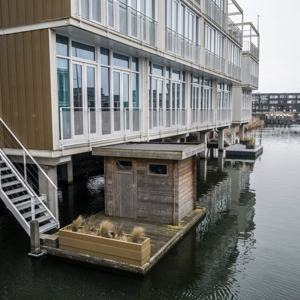
They’re are also experimenting with a whole new approach to urban development: floating buildings, like a “floating pavilion” on the Rijnhaven, the old harbor in downtown Rotterdam.
It’s made of two geodesic domes and can host 400 people for exhibitions and events.
“It’s a working building,” says Hans Baggerman, who runs the pavilion’s main tenant, showing off a theater and event space. “It’s even less for show than you’d expect. It’s not an expo.”

The pavilion floats on a platform of styrofoam, concrete and high-tech cushions. The domes are inflated bubbles of ultra-light plastic that resonate like a giant balloon when it rains.
Floating buildings are still a boutique solution, of course, even in Rotterdam. But Baggerman says buildings like this could become more common as climate change forces developers to get creative.
“Because a lot of parts of Holland are outside of the dikes,” he says. “There’s no way you can build buildings unless they are floating.”
All these innovations and more have made the Netherlands a mecca for people from other parts of the world that are confronting a future of rising seas. Delegations from abroad are constantly scouring the country for ideas, and the Dutch are more than eager to share their expertise — in no small part because Dutch engineers and consultants specializing in climate change adaptation and water management stand to benefit from international business partnerships.
But that doesn’t mean they’re complacent.
“We keep on learning and adapting,” says Carola van Gelder, a senior advisor for the national water management authority and a lead on the Zandmotor project. “It’s not that we know it all, definitely not … That’s why we go abroad and look at other ways of dealing with climate change. Because we learn a lot from other countries as well, and we try to adapt that to our system.”
And with the effects of sea level rise just beginning to pile up, adapting to it might remain a work in progress for centuries, even for the Dutch.


Cities Underwater:
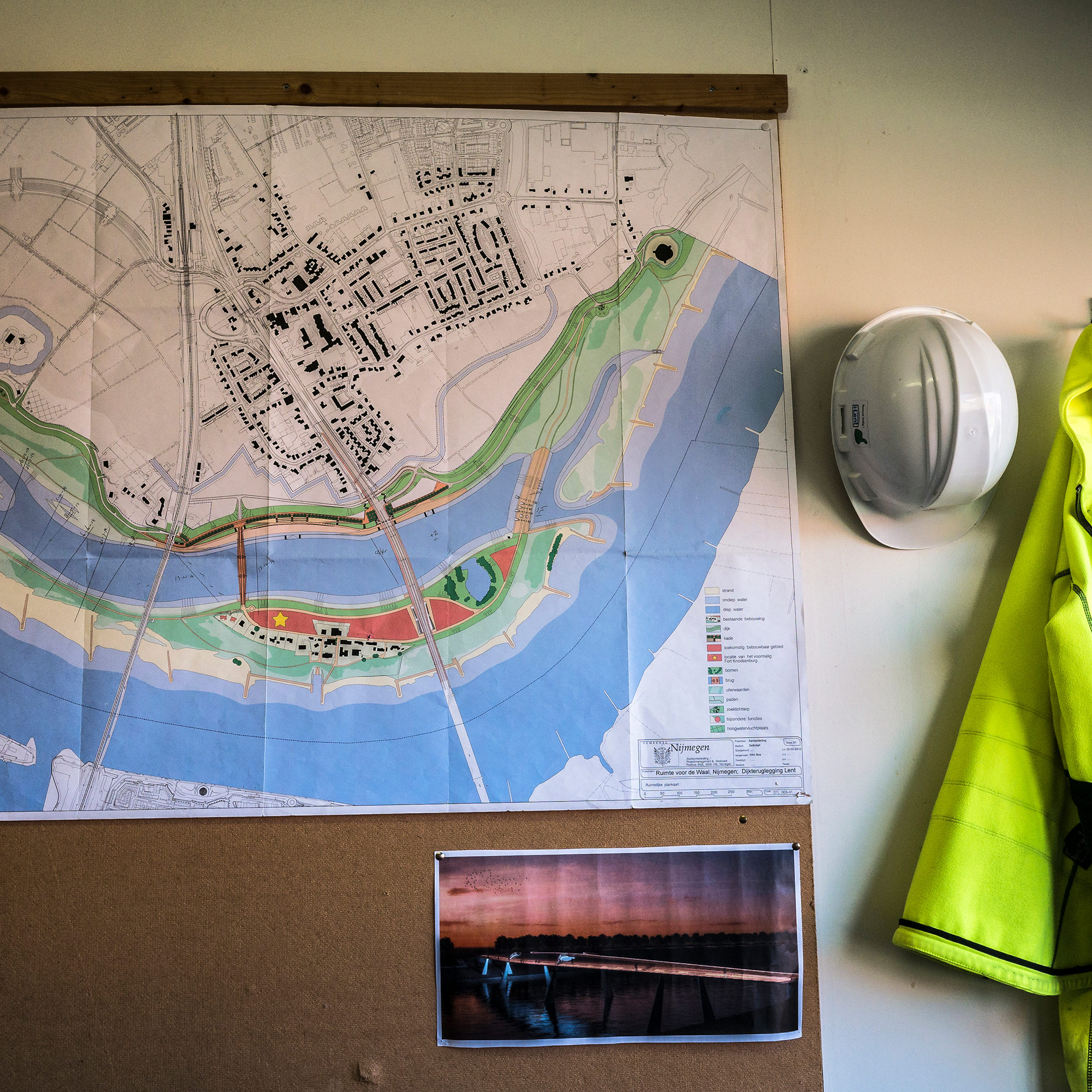
Holland is relocating homes to make 'room for the river'
NIJMEGEN, Netherlands — The Dutch have been the world’s experts at building dikes and keeping back water for centuries. Building dikes to hold back high water is pretty much how the country was formed hundreds of years ago.

But the Dutch relationship with dikes is changing. And there’s no better way to see that change than from … atop a dike.
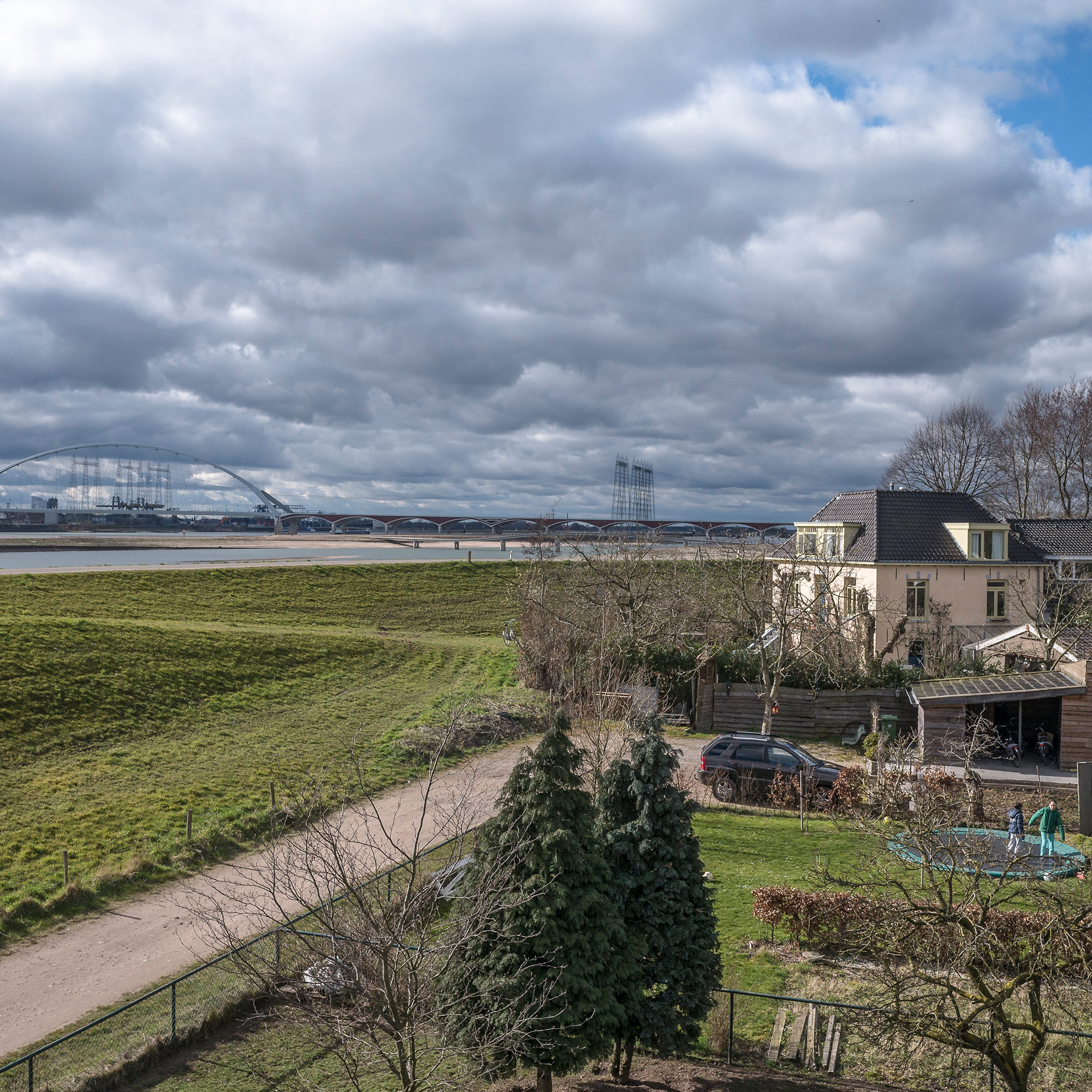
The one Mathieu Schouten was riding his bike along recently is in Nijmegen, an old city near the German border. Nijmegen sits at a bottleneck on a branch of the Rhine River. Flooding’s been a big risk there pretty much forever, so the Dutch have built and reinforced dikes there pretty much forever to protect the city.
But Schouten, a landscape architect, says that about 20 years ago, those defenses started to crack.
“In 1993 and 1995 the dike almost failed and 200,000 people were evacuated,” Schouten says. “That was really a wake-up call.”
Another wake-up call came in 2000, when new climate change projections showed likely flooding and sea level rise overwhelming many of the country’s dikes. So the Dutch made a big change. Instead of building higher dikes to defend against water, they came up with a new approach, which they called “Room for the River.”
Basically, the government conceded that it can’t avoid flooding from either the rivers or the sea entirely. Better instead, they decided, to try to manage floods by clearing out space for high water.
Here in Nijmegen, that meant moving the dikes back and recreating some of the river’s original floodplain.

But the Netherlands is a crowded place. So dozens of families were living in that floodplain.
Schouten says the families behind the dikes dug in their heels, and it took years of negotiations to work out an acceptable plan.
But in the end, he says, “They are the best ambassadors for us yet.”
Frank and Monique Pluym are two of those ambassadors. They had a house and an auto body shop in the proposed new floodplain. Three of their four kids grew up there.
“At first we said, ‘No, we don’t want it,’” says Frank Pluym, standing on the construction site where his home used to be.
“It was a long time for not knowing where we can live, where we can go … with our work,” Pluym adds.
But after 11 years haggling with the Dutch government, the Pluyms took a buyout and moved across the river. They remembered the floods of the ‘90s. And ultimately, they say they got a fair deal for their land.
“All the people here have money from government,” says Frank. “Compensation was good, and all the people built new houses. We built a new house, new garage.”
Monique agrees. The Room for the River project created a huge public park on an island in the river, which the Pluyms look forward to visiting once its complete.
“It was a difficult period but I think most of the people [who] did it, they are satisfied,” she says.

The Pluyms’ new house is just up the road from their old place. It’s bigger and taller. Since it’s still close to the river it sits on stilts. And they say they love their new view of the water and the sky.
Not everyone stayed so close. One family took their buyout money and moved to Italy. The Pluyms adopted that family’s cat.
Nijmegen isn’t the only Room for the River project uprooting neighborhoods. Sail down a branch of the Rhine known as the Waal about 50 miles and you come to an area of forests, wetlands and small villages just east of Rotterdam called the Biesbosch.
“The Biesbosch is a big nature area,” says Robbert de Koning, “but people live here, too.” De Koning is another landscape architect who worked on what’s known as the “Noorwaard depoldering.” A “polder” is what the Dutch call the low-lying area behind a dike. And Noordwaard is a big one.
It’s an area where two big rivers, the Waal and the Meuse, come together. Like in Nijmegen, the Dutch government decided to essentially abandon the flood protections at Noordwaard. The new plan was to let the water spread out here, to prevent catastrophic floods in more populated places elsewhere.
“It’s not preventing floods, but it’s preventing a dike breach,” says de Koning.
There’s an added benefit, too. The project restored 25 miles of creeks, creating a wetland that’s already popular with birders and bikers from all over the country.
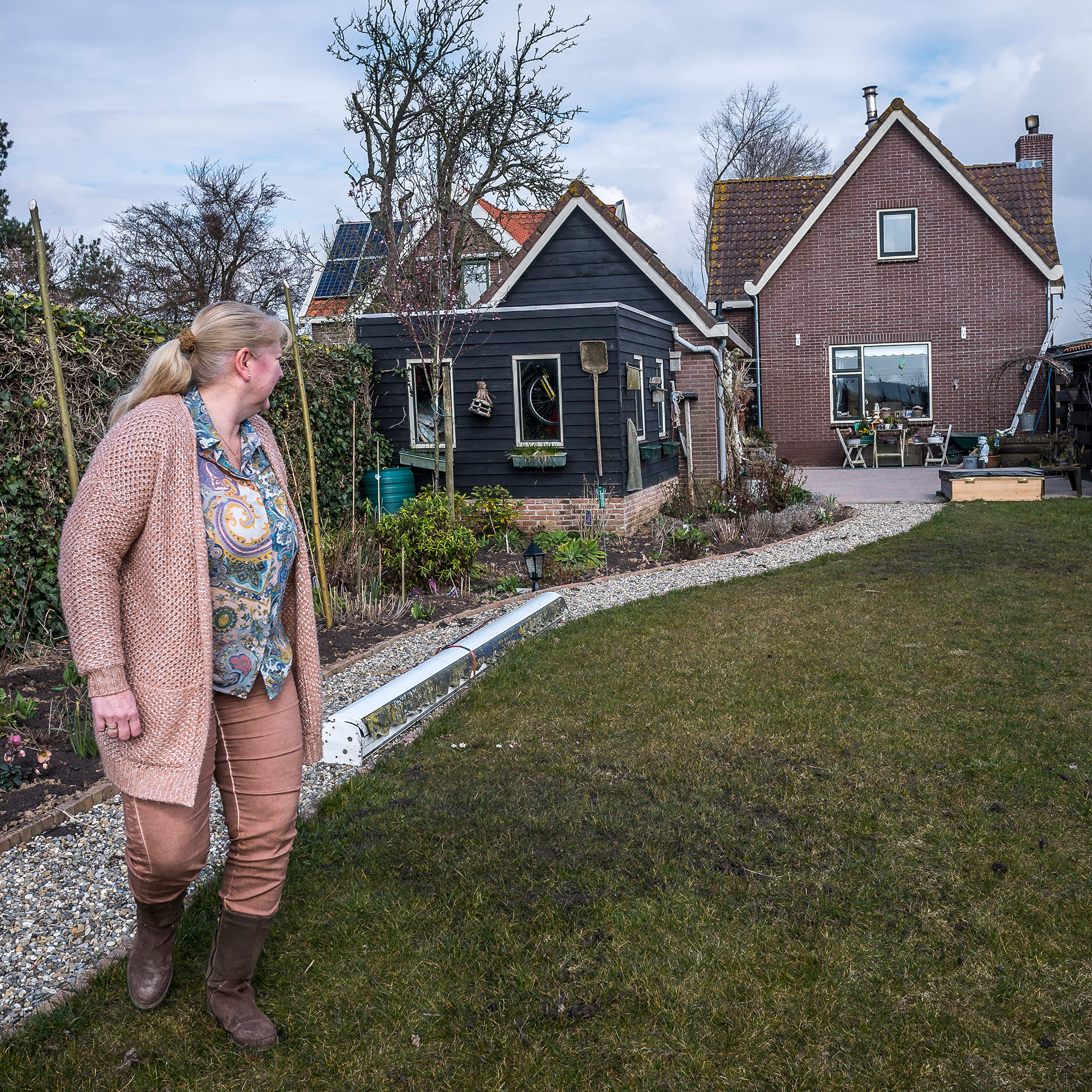
But before it was a flood control project, the Noordwaard was a village. And people still live there. People like Anneke van Lelieveld.
Her family has lived in the area for generations. So 20 years ago, when the government first started talking about “depoldering” the Noordwaard, van Lelieveld got involved.
“It was a long time, it was a hard time,” she says over tea and stroopwafels at her house in the Noordwaard. “It was a learning process for everyone. For us, but also for the government.”

Ultimately, the government gave people a choice: If your house was at least a meter above the new high-water level, you could stay. If not, they’d buy it, raise the land on your property, and then let you rebuild.
Van Lelieveld’s house is on a levee, already high up, so she didn’t have to move. But her garden became a construction zone. And a lot of her neighbors are gone.
“Everything was out. Every tree, every building, every plant. Everything. And they said to us it was going to be for six months,” van Lelieveld says. “But it was four years.”
She’s happy to have her garden back, and some small compensation from the government. The new wetlands are also nice, she says. Van Lelieveld has a boat that she uses to explore the new creeks created by the depoldering project. She spends the night on her boat sometimes, and occasionally glimpses sea eagles — a once-rare bird of prey that has returned to the region.
She loves the return of nature to her home. But she’s also ambivalent.
“Sometimes it’s hard for me,” she says. “When I go with my boat, one moment it’s amazing, but sometimes I have also some tears. Because I miss my neighbors. It’s a mixed-up emotion.”
It’s complicated for people like van Lelieveld. She’s sad about what’s being lost, but she’s proud that people are visiting from all over the world to see what the Dutch are doing to prepare for a new future.
“Because the Dutch people have always been building dikes, dikes, dikes,” she says. “And now they’re crazy — they’re giving land back to the river! But there’s something changing. The climate is changing. There are troubles. And well, there must something happen.”
What’s happening here is painful. But the Dutch believe the alternative is far worse.
And that may make the Netherlands an example for other low-lying regions facing the same tradeoff: sacrifice today, or risk even more tomorrow.
Cities Underwater:
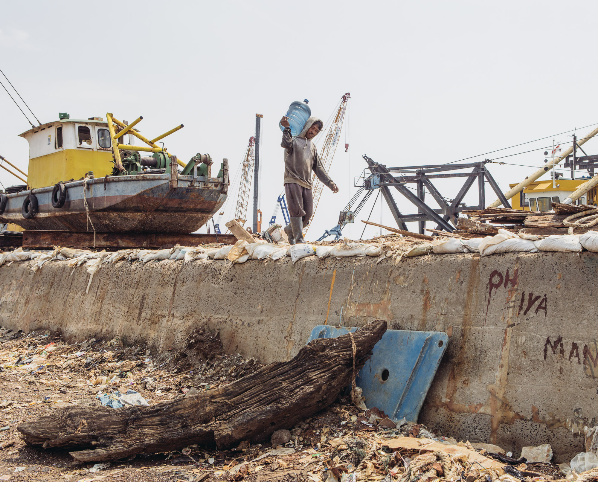
The human costs of protecting Jakarta

The Java Sea to the north. Thirteen rivers flowing through the city from mountains to the south. For as long as it’s been inhabited, the Indonesian capital, Jakarta, has been regularly inundated by these two forces of nature.
Now, confronted by increasingly heavy monsoon rains, rising seas and other challenges, the metro area of 30 million people is facing a dire threat from climate change.
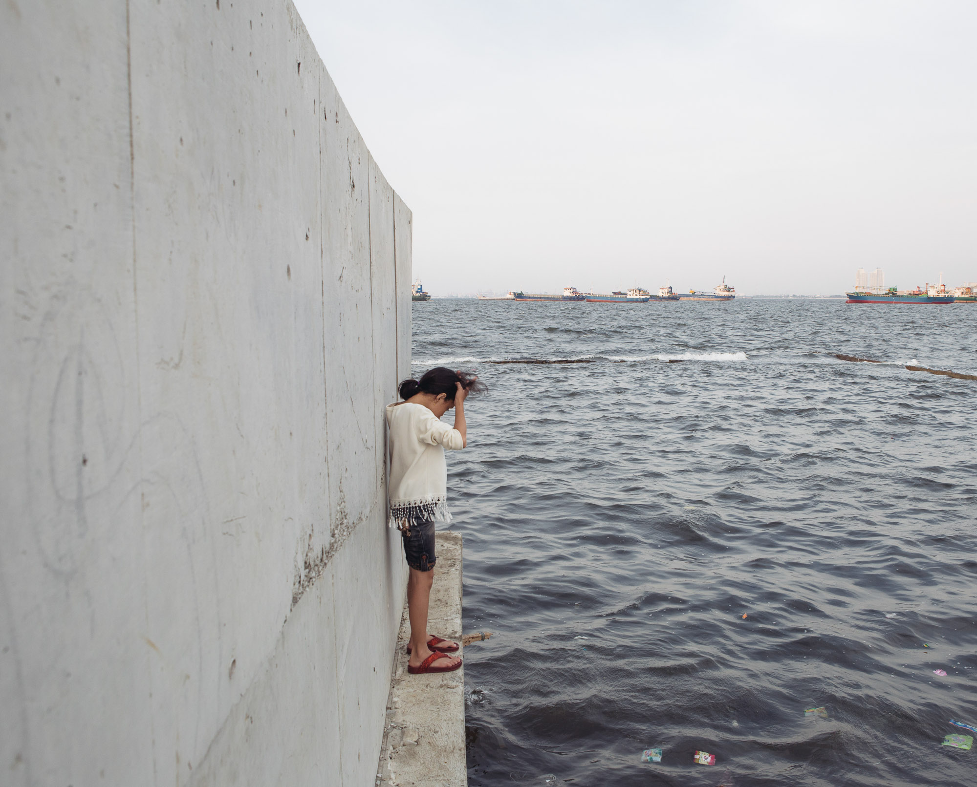
A good place to see what’s at stake is in north Jakarta, where a leaky concrete seawall is the only thing holding back the Java Sea from flooding almost half of the city. Even on a clear day, the seawall is just a few inches from overtopping.
“Basically this is a life threatening situation,” says Victor Coenen, an engineer for the Dutch engineering firm Witteveen+Bos, whom the Indonesian government has asked for help shoring up its flood-control infrastructure.
“If this seawall breaks, you have three meters of water in this kampung area where nobody can swim.”
“Kampung” means village, and it’s what Indonesians call the kind of neighborhood below the wall. This is a working-class community, where people live under asbestos roofs and earn a meager living by fishing in the bay or selling snacks on the street.

Roughly 100,000 people live right next to the seawall, well below the sea level.
Rising water, sinking land
About 40 percent of Jakarta today is below sea-level, and that share is growing. That’s partly because climate change is slowly raising sea levels, but the bigger problem right now is that much of Jakarta itself is sinking as the water table beneath the city depletes. Jakarta has some of the world’s highest rates of land subsidence, with some parts sinking nearly 10 inches per year.
“It’s really a problem on top of another problem, making things even more difficult,” Coenen says.
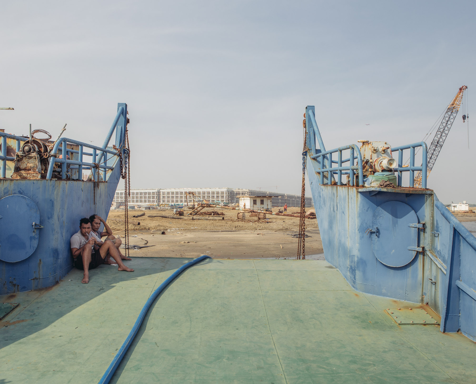
Jakarta’s problems managing water have piled up over decades as it ballooned into one of the biggest cities on Earth. Now the Indonesian government is trying to address some of them with an ambitious “national coastal development” strategy. It includes a $30 billion plan to build a new seawall, 300 miles long, and to enclose Jakarta Bay behind a chain of artificial islands.
But the plan isn’t popular with some of the very people it’s supposed to protect.
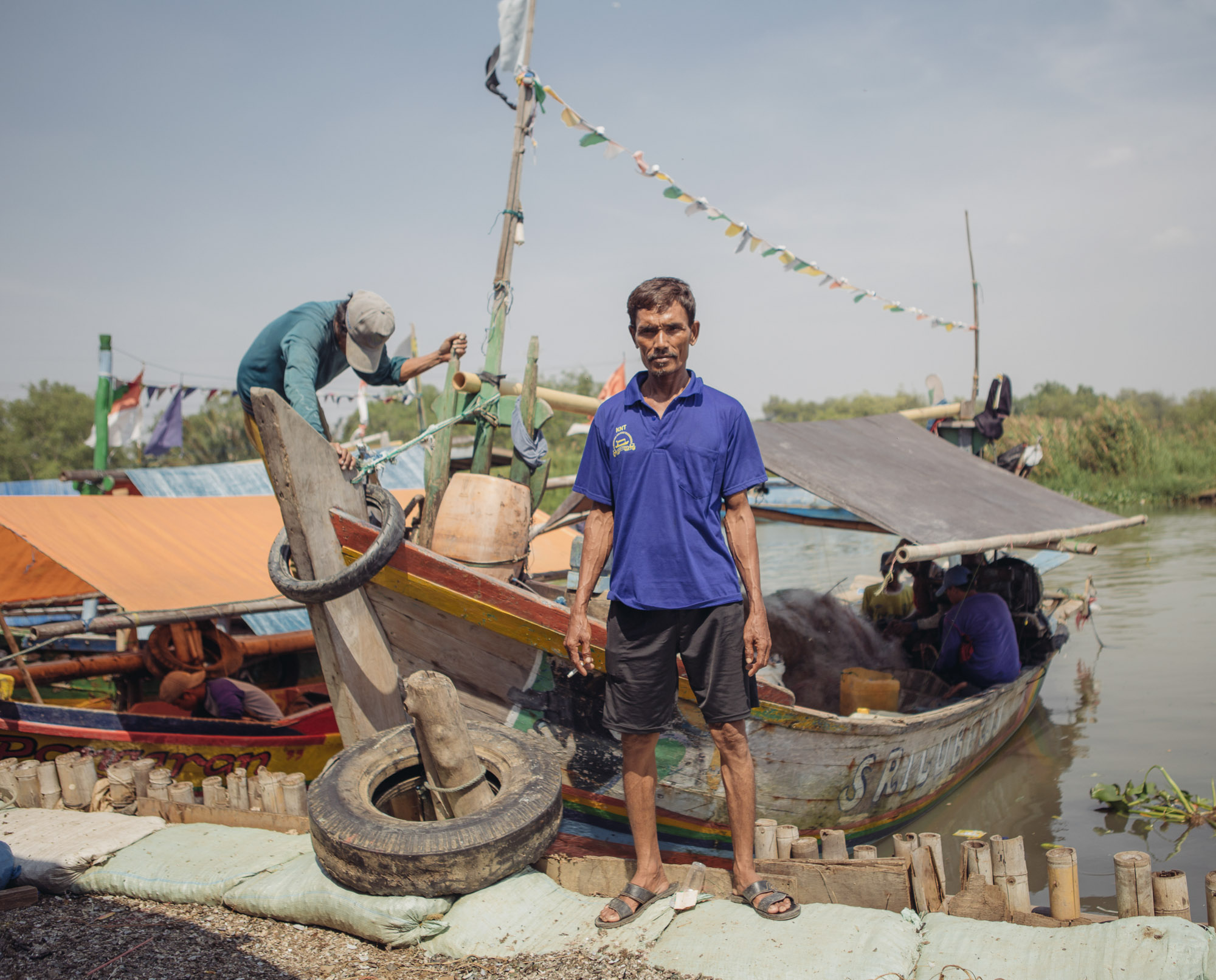
Kuat Wibisono, who leads a fishermen’s group in a seaside kampung called Muara Angke, says new islands in the bay are already affecting local fishermen’s catch. He acknowledges that flooding can be a real problem, but he doesn’t think the bay development plan will solve that, or anything else.

“We don’t really see how the reclamation project will improve (our) economy, or how it will benefit us socially or environmentally, because the reclamation is burying our fishing area,” Wibisono says.
And he faults the process as well.
Wibisono claims local fishermen only found out about the government’s plans when their boats started running aground in unfamiliar places, where engineers were already raising the seafloor for new artificial islands.
“There was not any discussion, or announcement to our community from government. [It’s] as if Jakarta Bay is theirs,” he says.
Wisbono’s group successfully sued to stop the construction of artificial islands. There’s currently a moratorium on new islands, and later this year the country’s president is supposed to weigh in on whether construction can continue.
Wibisono says he thinks the real motivation for Jakarta’s land reclamation isn’t flood control, but making more room for rich people. That’s because the new seawall and protective islands would be financed by leasing the newly created land to wealthy developers.
Engineer Victor Coenen understands that sounds like a land grab.
“This does create the image that this is a project for the rich,” Coenen says. “Unfortunately, if you don’t want to do it with this kind of high-end development, then you have to find some public money. And public money is scarce in Indonesia.”

Riverside evictions
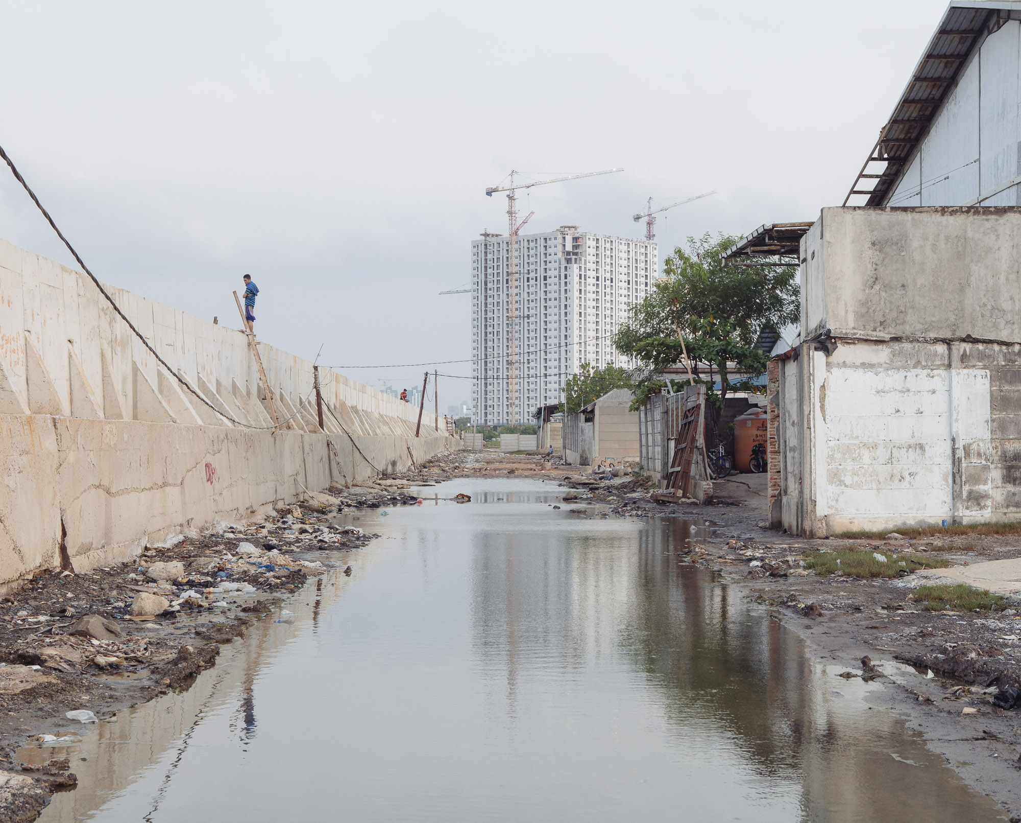
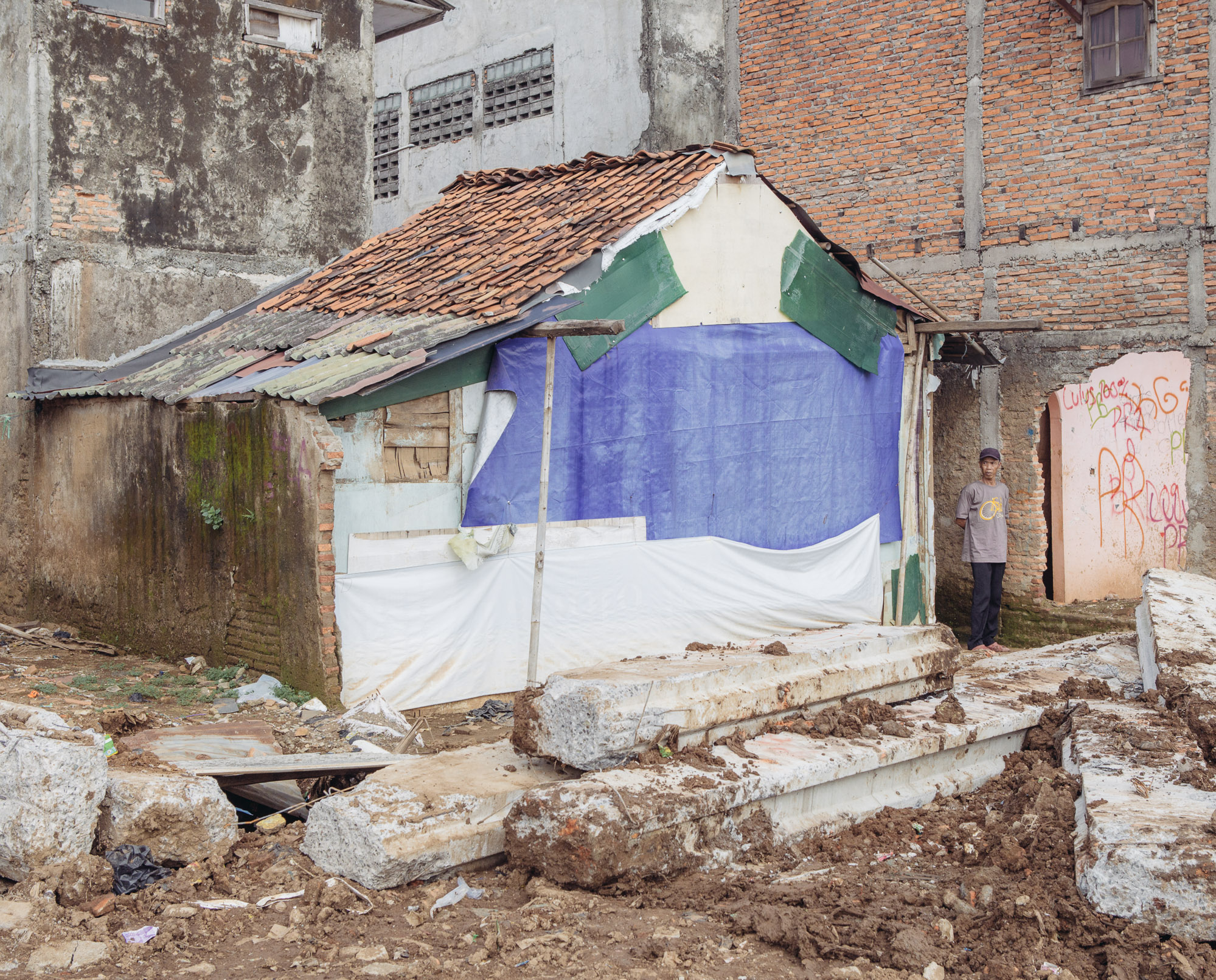
One place where public money is being spent to try to help address Jakarta’s flooding problem is inland, where Jakarta’s 13 rivers are choking on the twin problems of trash and overcrowding. Millions of people live along riverbanks in kampung neighborhoods of cement and brick houses and bamboo shacks, and many residents toss their garbage and even defecate directly into the rivers.
“People still put rubbish in the river because they don’t have to pay,” says Sri Tantri Arundhati, Indonesia’s director of climate change adaptation.
Arundhati says trash can clog pumps and dams, and prevent the rivers from draining to the sea. “(So) you have to solve first the drainage problem”
Overcrowded riverbanks can make flooding worse, and lead to disaster during severe floods.
The government’s answer to these twin problems is to relocate as many as 100,000 riverside residents to new subsidized apartment buildings, widen the rivers so they can hold more stormwater and install levees to hem in high water.
Of course the plan also means demolishing vibrant communities that in some cases have been here for generations, even if many were never quite legal.
“It’s government land,” says Arundhati.
Most kampung residents are squatters, although many of those evicted claim they had title to their land, sometimes dating back to Jakarta’s Dutch colonial days.

But Arundhati says the neighborhoods are not only flood-prone, they’re dangerous.
“Removing them and giving them proper housing, I think it’s better for their health,” Arundhati says. “And for Jakarta I think it’s healthier to have a river more managed than before.”
Neighborhood resistance
Here, too, though, the flood control plans are meeting with pushback.
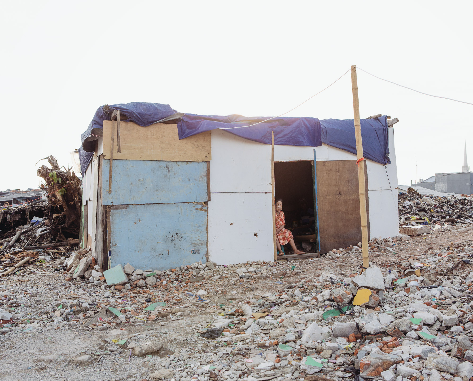
Hundreds of families have filed class action lawsuits against their evictions. Some continue to squat in tents erected on the ruins of their bulldozed neighborhoods. There have been clashes with police when residents have refused to leave.
“I can’t accept it. It felt like my heart was torn into pieces,” says a former resident of the kampung named Syafitriani.
Syafitriani says she was given just four months’ notice before bulldozers arrived one morning at 7 a.m. to level her neighborhood.
She says she owned the land and paid taxes on it for 25 years, and she stayed to protest its demolition.
“I stood in front of my house,” Syafitriani says. “I was crying, shouting.”
More than a year later, she’s still fighting for compensation. She’s moved into one of the new high rises, but she says she makes less money there selling snacks from a cart than she did from her home by the river, and she’s having trouble paying the rent.

To make things worse, Syafitriani says her new apartment leaks. So after being evicted for a flood control project, she still has to deal with pools of water when it rains.
Jakarta Post journalist Evi Mariani, who’s been covering forced evictions since 2003, agrees that there’s a real need for flood control projects in the city, but she says the relocations are also a convenient excuse to make Jakarta more upscale and touristy like Singapore.
“(The residents are) just being called … the great unwashed of Jakarta,” Mariani says. But the new social housing is “not taking into account their needs … They probably don’t get flooded anymore, but their life is much harder.”
A lesson for other cities
As for other possible measures that have been floated to help fight flooding in Jakarta — things like replacing open space, restoring the water table, even somehow shrinking the size of the sprawling city — there’s little effort to carry those out.
Victor Coenen, the Dutch engineer, acknowledges that the big technical fixes being proposed and implemented to address Jakarta’s massive flooding problems only get at part of the problem. Even the most basic fix — like repairing the existing seawall — disrupts a way of life for kampung residents who actually live on top of it.

“If you strengthen the seawall … these people will lose their livelihood,” Coenen says. “It’s not a technical solution that’s the problem, it’s the social problem.”
Some Indonesians see Jakarta’s mountain of challenges managing water as a window into the future for many coastal cities around the world as climate change brings rising water over the next few decades and beyond.
Coenen agrees that here in Jakarta, there are already no good choices, especially for the city’s most vulnerable residents.
But he says other coastal cities still have time to start planning ahead.
“The lesson for other cities is act while you still can,” Coenen says, “and then you can avoid these mega-engineering solutions.”
It’s a reminder, he says, that while it’s possible to engineer solutions to climate change, the hard part is finding solutions that are fair to the vulnerable people they’re designed to protect in the first place.


Cities Underwater:
Hear the podcast & explore the science
Behind the Science
Jakarta, Indonesia, is a low-lying coastal city where nearly half of the population currently lives below sea level. The city has three big problems with water. First and foremost, the city is sinking. As Jakartans pump out groundwater beneath their feet, they’re causing what geologists call land subsidence. Parts of Jakarta, including the seaside area of Pluit, are sinking nearly 8 inches each year. The city is growing, and the problem is getting worse – the local water authority estimates illegal groundwater pumping has increased tenfold in recent years.
Land subsidence is not climate change. But it is exacerbating Jakarta’s other two problems with water, which are getting worse thanks to global warming.
Like most coastal cities, Jakarta is also threatened by sea level rise. As the global average temperature of the Earth rises due to the greenhouse effect, the oceans are getting bigger. This happens through a combination of thermal expansion (water expands when it’s warmed up) and the melting of ice sheets mainly in the Arctic, Greenland and Antarctica. Global sea levels have already risen about 8 inches since 1880, and the rate of sea level rise is accelerating. How much more sea level rise will occur is still hotly debated, but climate scientists predict between 2 and 7 feet by the year 2100.
Jakarta’s third problem is rain and riverine flooding. Thirteen rivers flow through the Jakarta metropolitan area, collecting rain and runoff as they meander down from the mountains to the south of the city on their way to the Java Sea. Globally, climate change is expected to supercharge storm systems because air can hold more moisture at higher temperatures. In any given area, this could lead to an overall increase in rainfall, an increase in droughts, or an increase in the number of extreme storms. In Jakarta it is increasing rainfall and making the region’s monsoon climate more extreme. Land subsidence also makes things worse here because Jakarta’s rivers are sinking along with the city, making it easier for rainfall and runoff to pool up in Jakarta instead of draining quickly to the sea.
The combination of sea level rise, extreme precipitation events and runaway land subsidence has put Jakarta in an extreme situation: If nothing is done, this city of nearly 10 million could be underwater by 2050.
Cities Underwater:
How crowdsourcing helps people in Jakarta stay safe from floods

Like millions of Jakartans, Dedi Setiawan lives along one of the city’s 13 rivers, in a village-style neighborhood called a kampung. The area’s unpaved paths are jammed with people selling snacks and cell phone credits out of carts, residents hang laundry out to dry between bamboo shacks and small brick homes, and the river crossing is a wooden boat pulled along a wire strung between the banks.
Life along Jakarta’s rivers can be challenging. The city faces some of the worst flooding problems of any major urban area in the world, in part because those 13 rivers, often swollen by monsoon rains, drain into a dense urban area that’s rapidly sinking below sea level.
In 2013, rising waters sent Setiawan scrambling to the second floor of his house, and during the flood, he couldn’t get in touch with anyone to find out what was going on elsewhere.
“Back then we didn’t have the communication system,” he says.
But the growth of social media has changed that.
“Now we mainly use WhatsApp and Facebook groups to communicate with each other,” he says.
Word spreads organically — people upriver might text their friends a photo of flooding in their part of town so their neighbors downstream can prepare.

Going online for flood information is faster than waiting for official announcements, and residents say they trust the information more because it’s coming from a real person.
Fajar Inayati, who lives upriver from Setiawan, says during a recent flood her friends were sharing photos before the government could get the word out, and even before it hit the local news.
“We were not at the area where the flood came, but we heard it from our friends who shared it,” Inayati says. “They were there, so I believe that the news must be reliable and factual.”
The social media posts prompted her and her neighbors to start prepping sandbags to keep the water at bay.
Of course social media can also be unreliable sometimes. Rumors spread fast, and even good information can get drowned out in the chaos of a natural disaster.
Faster and more reliable
That’s where PetaJakarta comes in. It’s an open-source, real-time, online map of the city that automatically filters Tweets about flooding to improve accuracy and fill in the gaps between official city reports.

When someone tweets “banjir” — the Indonesian word for flood — and tags @PetaJkt, PetaJakarta automatically replies, asking them to verify the tweet with geotagged photos. The app then combines all those reports with official data from the city into an up-to-the-minute, online flood map that can be more reliable than other social posts.
“If you have four people with photos at different angles showing one event, that’s a pretty difficult thing to stage,” says Etienne Turpin, a Canadian-born designer and research scientist at MIT’s Urban Risk Lab. He founded PetaJakarta in 2014 along with colleague Tomas Holderness. Today they operate an eight-person team of mostly local residents out of an office in Jakarta’s Guntur neighborhood.
Holderness and Turpin both study disaster resilience, and that’s what drew them to Jakarta. Turpin says he once heard Indonesia referred to as a “living laboratory for disaster.” And Jakarta, he says, “is the sort of center of that laboratory.”
By one estimate, Jakarta is also the world’s capital of Twitter activity, which Turpin says makes it a goldmine of data, full of what he calls “human sensors” for tracking disasters and vetting real-time reports.
Compare PetaJakarta’s real-time flood mapping with the city’s standard practice of circulating static PDF maps every six hours.
“If you want to decide if you should leave work early to pick up your children from school, or check on your elderly parents, having a picture of a map every six hours doesn’t give you a lot of confidence about making those decisions,” Turpin says.
It’s about democratizing disaster management, he says.

“If decision support is just concentrated in the hands of the government, we have a bottleneck of information. But if real-time information is being collected, validated and shared, then we have 31 million decision makers deciding, ‘Should I drive this way? Should I avoid a certain area?’”
Given its speed and accuracy, even some government officials have turned to PetaJakarta. Soon after it went online, Jakarta’s governor urged his followers on Twitter to use PetaJakarta to tweet about flooding.
Anto Sugianto, who works for the city in the flood-prone northern district of Ancol, says PetaJakarta has become an important tool in flood response.
During a flood in April, Sugianto says he used PetaJakarta to help city teams decide where to deploy pumps to suck water away from important streets, and what roads to close to keep people from being trapped in their cars. His team even contributed their own geotagged photos to the site while they worked.
Sugianto says Petajakarta has begun to transform flood response in the city from a top-down effort to a cooperative relationship between the city and its residents.
“It’s not only that the Kelurahan [district] can give information to the public,” Sugianto says. “Now we get information from them, too. Give and get.”
A model for elsewhere
And PetaJakarta is getting noticed beyond Indonesia. Both the U.S. Federal Communications Commission and the International Federation of the Red Cross and Red Crescent have cited PetaJakarta as a model of community engagement in disaster response.
Of course, better online mapping won’t help actually prevent the flooding that plagues Jakartans like Dedi Setiawan and Fajar Inayati. That would take an overhaul of the city’s stormwater system, including new urban planning ideas and investments in green infrastructure to restore some of Jakarta’s paved-over landscape.
But as cities like Jakarta struggle to adapt to the new normal of high water that’s coming with global warming, online tools like PetaJakarta may help them live better with what they can’t change — and connect with each other while they do.
Cities Underwater:
Along the water's edge
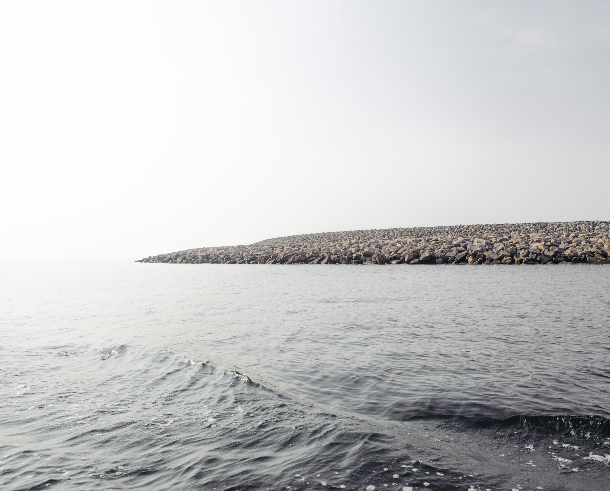
There’s evidence that climate change is already causing serious damage to communities across New England, where waters along the East Coast are rising, shorelines are eroding and severe storms are becoming more frequent. By the end of the century, New England could see sea levels up to 7 feet higher than they are now.
The effects of climate change have been devastating for those Massachusetts towns and communities along the water’s edge, where intensifying storms and flooding have ruined both homes and livelihoods. In Boston alone, damage from storms could cost the city billions of dollars this century.
Facing the threat of rising sea levels, many coastal residents are deciding to stay and adapt their homes and infrastructure, rather than relocate.
“If you don’t want to risk losing your home … don’t build on Plum Island,” says Verne Fisher, who has lived on the island for more than 20 years. “If you love this environment and the way of life you take the risk. I take that risk.”
The lengths to which seaside communities like Plum Island and residents like Fisher go to stay at the water’s edge are measurable, costing taxpayers millions of dollars a year. When residents seek to rebuild part or all of their home after a storm, they are required to follow flood adaptation mandates—required guidelines for new coastal construction from the Federal Emergency Management Agency (FEMA) and the town’s Flood Mitigation Assistance and Hazard Mitigation Grant Programs—and they often receive funding from local and federal grants. Critics argue that public money is wrongly, and repeatedly, going to residents who are rebuilding houses in high flood risk areas. In 2015, one Scituate homeowner received $180,000 in federal grant money to rebuild a vacation home hit by at least 10 storms in a dozen years; it was the second grant the home had received.
Most homes located on beaches in places like Scituate and Plum Island are raised 20 feet on steel or concrete pilings that are planted an additional 30 feet into the ground. The communities are also constructing and redesigning different types of seawalls and natural barriers in the form of dunes, rocks and concrete walls that travel the length of the beach. These are expensive solutions with no long-term guarantee with climate change. Last month, Scituate received $1.7 million in federal money to repair one seawall, an amount that covered just 75 percent of the project.
After a busy summer of rebuilding, the towns are now bracing for the start of winter.
“Last winter, waves were crashing on the second story of that house,” says Scituate resident Devon Barrie as she points across the street to one of her neighbors. “But we just buckle down and ride it out. I know that the sea levels are rising and in 20, 50, 100 years, who knows if this will be here anymore. But given the chance to live here now, there’s nothing like it,” Barrie said.

Across New England, coastal waters are rising due to climate change. Plum Island, on the North Shore of Massachusetts, is particularly vulnerable to major flooding from storm surges and beach erosion. “Don’t build here if you’re afraid of losing your house,” says longtime resident Verne Fisher. (Photo by Lauren Owens Lambert/GroundTruth)

Homes hover dangerously close to the cliff’s edge in Plymouth, on the South Shore of Massachusetts. With up to 68 percent of beaches on the East Coast eroding, some residents are moving out. But many are not budging, choosing instead to bolster their homes and adapt to climate change. (Photo by Lauren Owens Lambert/GroundTruth)
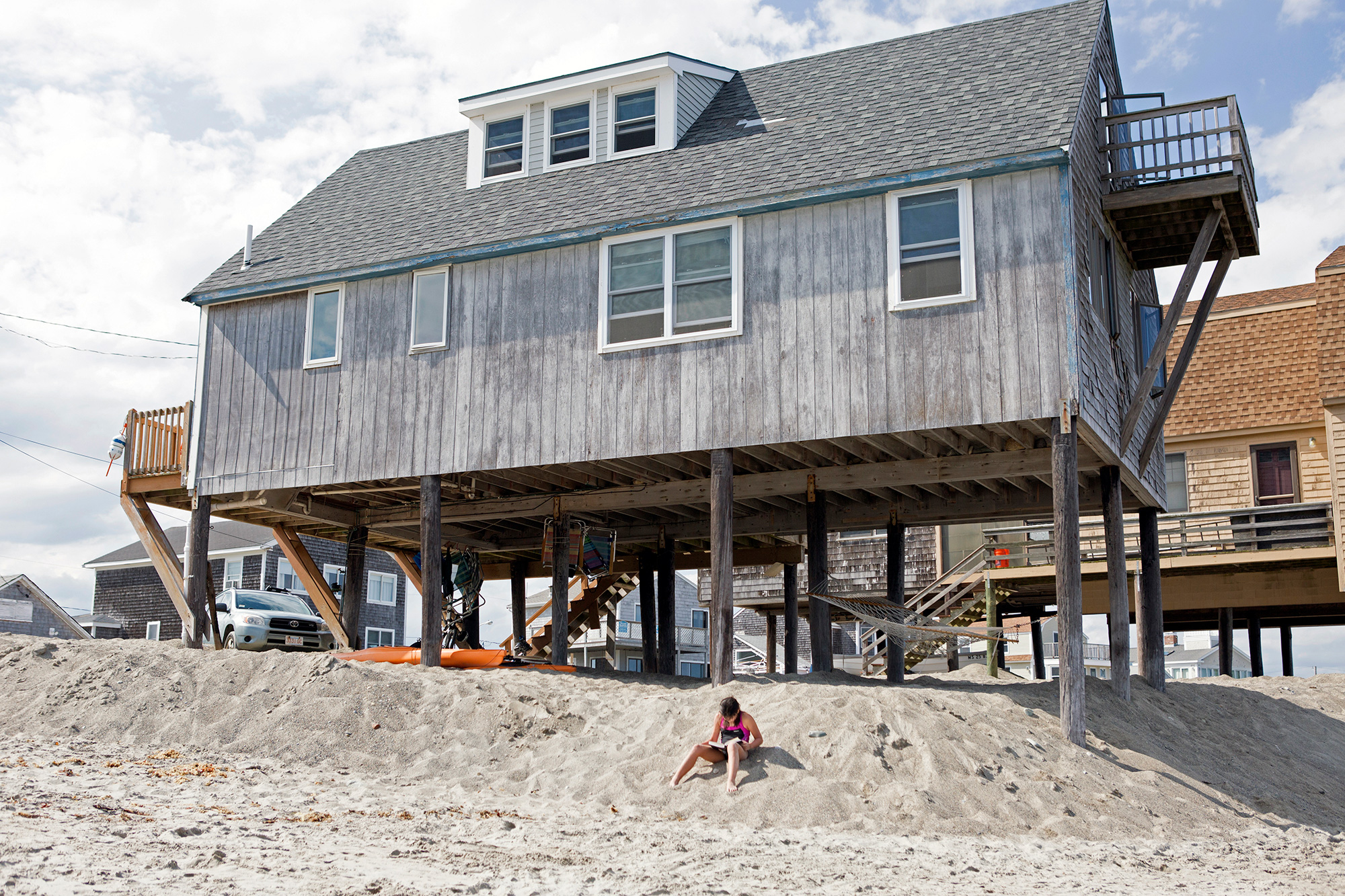
A girl reads her book by a raised cottage on Peggotty Beach in Scituate, on the South Shore of Massachusetts. Where there were once more than 50 cottages, the number has dwindled to a dozen as storms have eroded the beach and forced homeowners to vacate the area. Those houses that remain have been moved onto stilts. (Photo by Lauren Owens Lambert/GroundTruth)
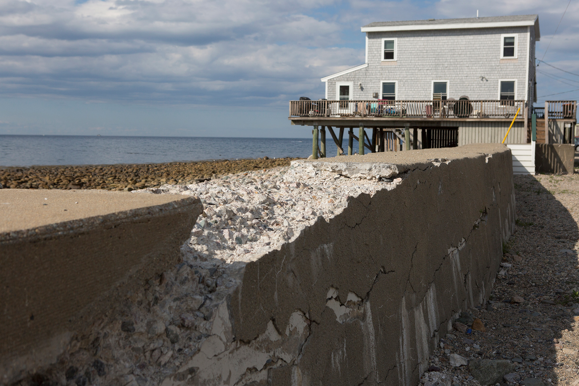
Next to a raised home in Scituate, a seawall crumbles—the result of years of ocean waves pummeling the shores. Most coastal towns along the Massachusetts South Shore have man-made sea walls in place to help protect the ocean front from storm surges. But recent storms have breached the seawalls and weakened them for future storms. (Photo by Lauren Owens Lambert/GroundTruth)
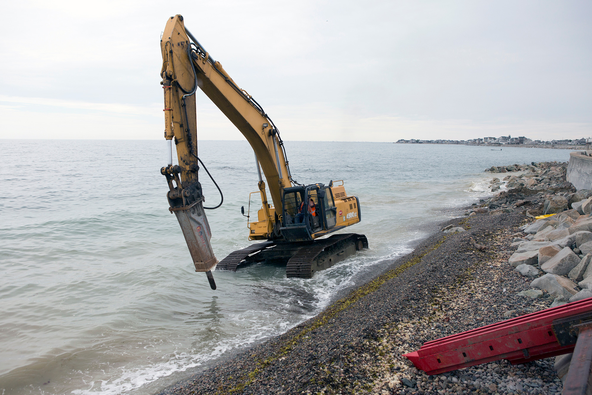
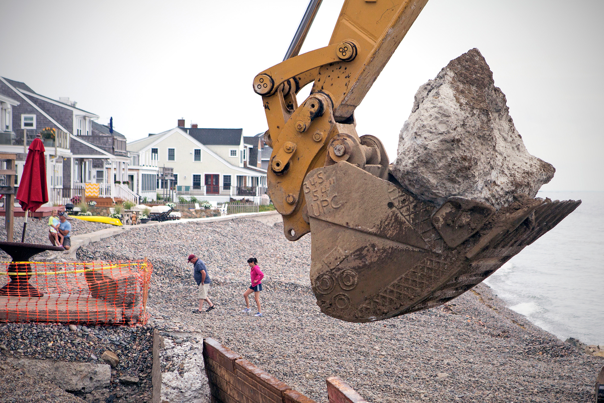
A wheel excavator travels up the rocky shore south of Egypt Beach in Scituate as construction workers rebuild a damaged seawall, originally built in the 1930s. The crew is increasing its height and strength with additional steel support and rocks. (Photo by Lauren Owens Lambert/GroundTruth)
Scituate residents walk along the shore just south of Egypt Beach in Scituate as workers replace the aging seawall. Recent studies estimate that the sea level could rise in New England by 2 to 7 feet by the end of the century – a result of climate change that would drive more storms and flooding and put thousands of homes and businesses at risk. (Photo by Lauren Owens Lambert/GroundTruth)
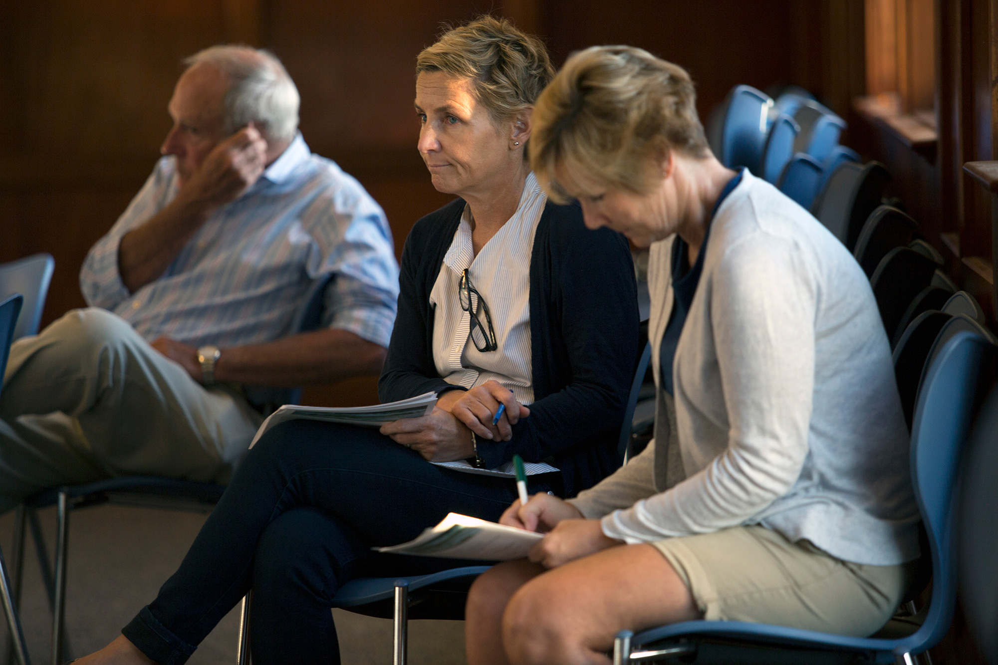
Scituate residents attend a town meeting on flood adaptation, preparation and management. Worry is evident on the faces of homeowners as they discuss the newly revised Federal Emergency Management Agency flood maps, which place more and sometimes unexpected homes at risk of flooding. According to the National Flood Insurance Program, a federal program managed by FEMA, floods are the number one natural disaster in America and in 2015 the national average policy premium was nearly $700 a month. That year, Massachusetts ranked among the top 10 states to receive the highest claims from the program —a total of $9,736,052. (Photo by Lauren Owens Lambert/GroundTruth)

Homes along Salisbury Beach in Massachusetts and neighboring Hampton Beach in New Hampshire face the Atlantic Ocean and are backed by miles of marsh. As sea level rise elevates the water table, flooding can come from the marsh instead of the ocean. (Photo by Lauren Owens Lambert/GroundTruth)
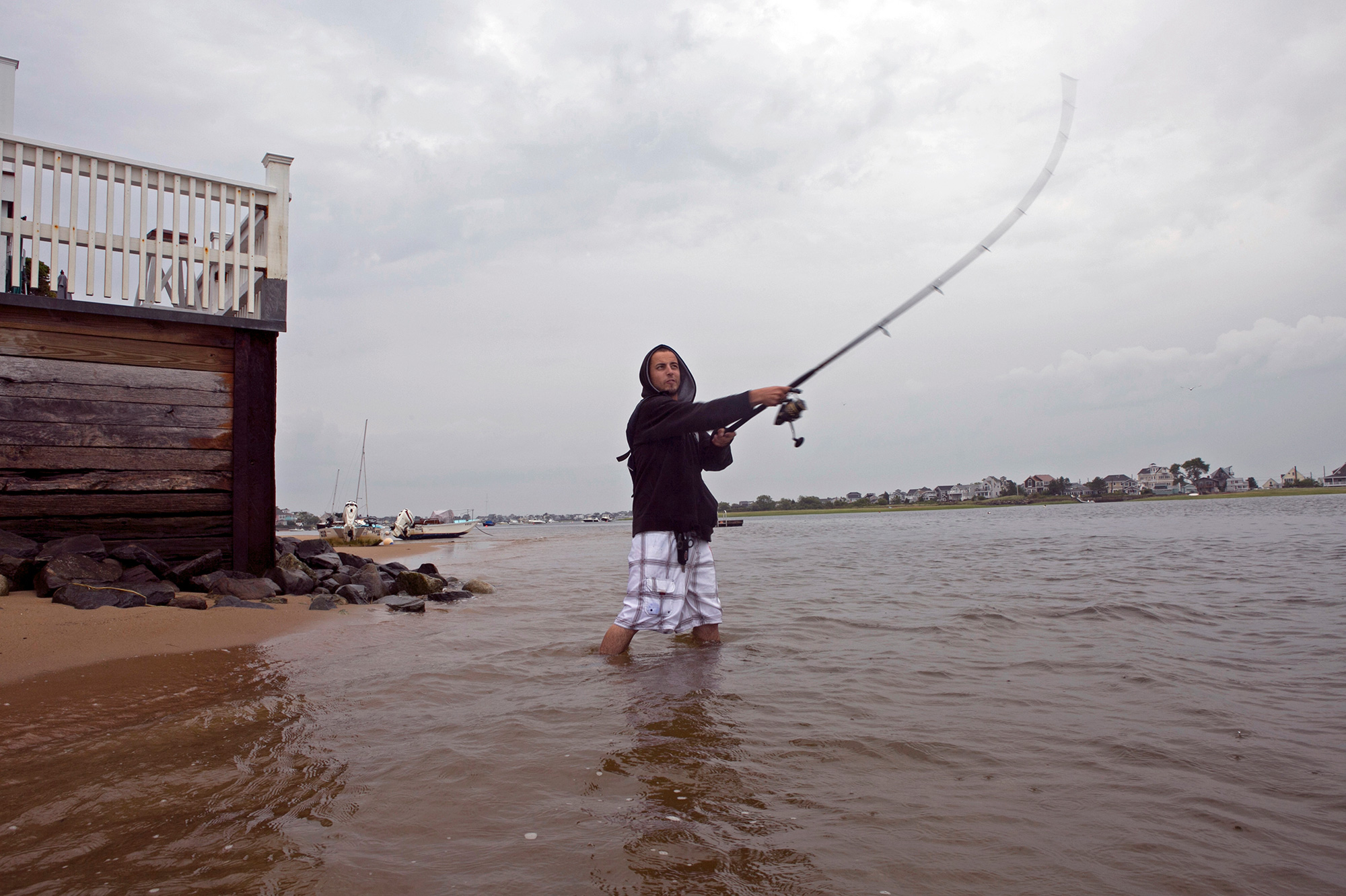
Marcos Rego fishes for striped bass on Plum Island early in the morning. During high tide, the water slaps against the building behind him. (Photo by Lauren Owens Lambert/GroundTruth)

The breakfast rush at Mad Martha’s Cafe on Plum Island. The restaurant is one of several local businesses built on a fragile ecosystem of sands that are constantly shifting. It is at risk of flooding and damage from rising sea levels and intensifying storm surges. (Photo by Lauren Owens Lambert/GroundTruth)
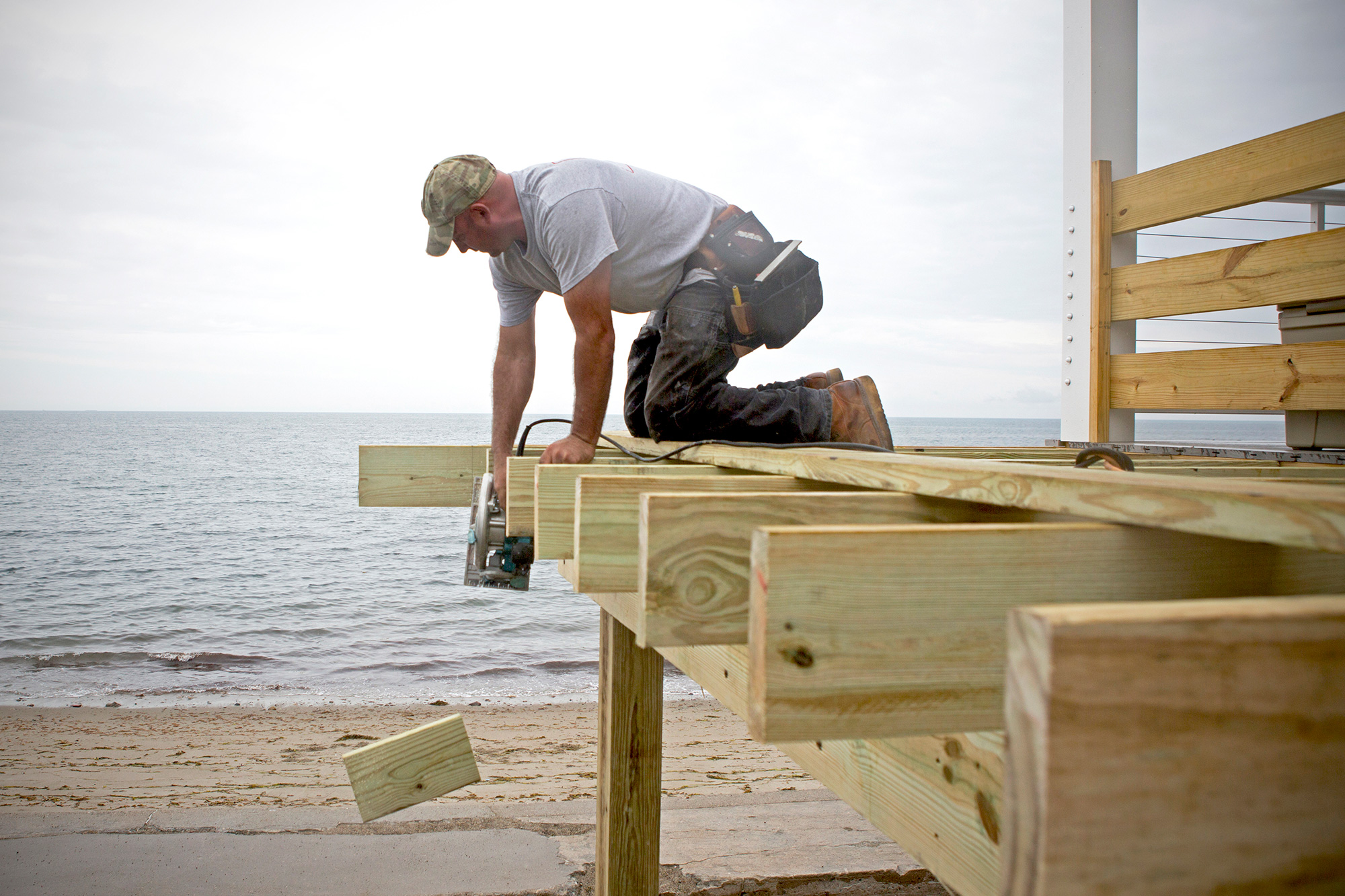
Fourth generation construction worker, Chris Pratt, of Pratt Custom Building, works on the deck of a raised home in Scituate. Business booms for Pratt during the summer months, when homeowners rebuild their houses after storms and prepare for future severe weather. (Photo by Lauren Owens Lambert/GroundTruth)

A wheel loader scoops up detritus from the ocean while rebuilding a road in Scituate following a 2015 winter storm that flooded dozens of homes, destroyed streets and power lines and even pulled buildings into the sea. Some homes in the town have been damaged and rebuilt more than 10 times with funding from the federal government and community tax money. (Photo by Lauren Owens Lambert/GroundTruth)

A group of friends head to the water with paddleboards on Plum Island, in front of several new homes that have been raised off the ground and adapted for rising sea levels. (Photo by Lauren Owens Lambert/GroundTruth)

Scituate homes are being raised 16 to 20 feet above sea level to comply with the ‘100-year-storm flood marker,’ a level that fluctuates depending on location. The town offers select grants to homeowners to adapt their homes for flooding through the Federal Hazard Mitigation Grant Program. Financial assistance can provide up to 75 percent of the total cost of the climate mitigation project. (Photo by Lauren Owens Lambert/GroundTruth)
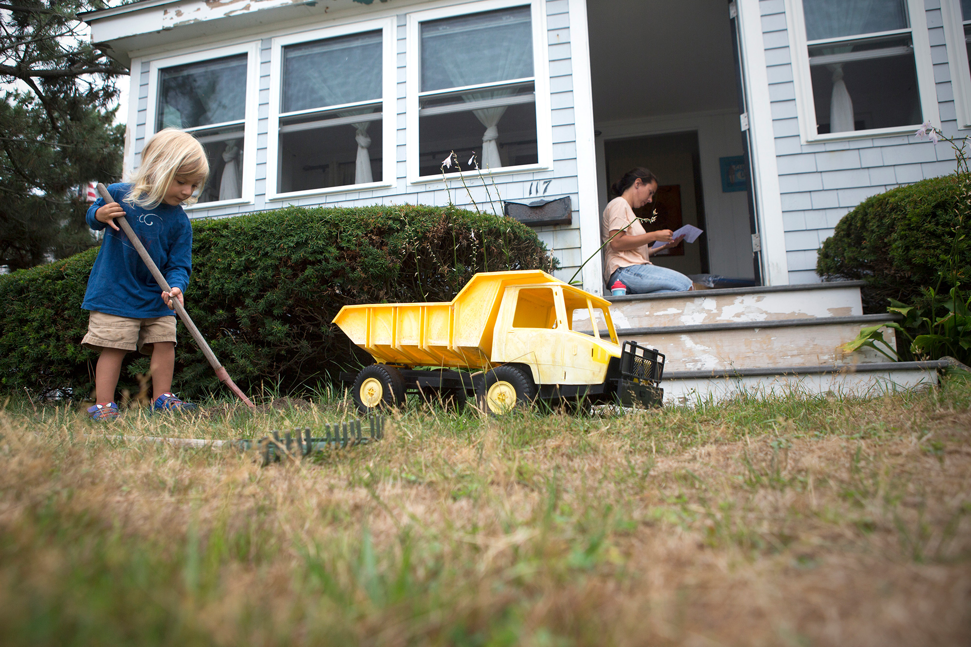
Scituate resident Devon Barrie and her son, Kailub Sullivan, live along the beach in Scituate near the new town seawall under construction. Sullivan likes to imitate the working crew with a toy dump truck, moving dirt from one side of the yard to the other. (Photo by Lauren Owens Lambert/GroundTruth)

Scituate resident Peter Caruso observes the construction of a new seawall in Scituate with his grandson, Santo Arias. The town hopes that bolstering the seawall will mitigate the severity of winter storms and the effects of sea level rise. “It is a tough spot to try and live and the storms are more frequent than they use to be,” says Caruso. (Photo by Lauren Owens Lambert/GroundTruth)
Homes and businesses on Plum Island come face-to-face with the Atlantic Ocean. “The big problem with climate change and sea level rise is that it’s a slow motion disaster and people don’t really perceive that it’s happening,” says Mike Morris of Storm Surge, a nonprofit organization in nearby Newburyport that helps communities prepare for the effects of climate change. (Photo by Lauren Owens Lambert/GroundTruth)
GroundTruth fellow and photojournalist Lauren Owens Lambert grew up on the South Shore of Massachusetts, and spent last summer documenting how residents there and along the North Shore are preparing for climate change. Reporting on and above the ground along the coast of the Bay State, she sheds light on the challenge – and controversy — of climate adaptation in vulnerable areas.
Arial flights made possible by: LightHawks
Cities Underwater:
How high will sea levels rise? Here's why it's so hard to predict
By Heather Goldstone, WGBH News

State and local officials are gathering today to discuss the impacts of rising sea levels on Massachusetts’ South Shore. But just what should they be planning for?
Sea level is expected to rise at least one to three feet this century. There’s concern that New England could see far more than that, but the science behind such predictions is rapidly evolving.
On a crisp fall afternoon, Magdalena Andres searched a dock in Woods Hole, on Cape Cod, for the source of some of the data at the heard of this debate. An oceanographer at Woods Hole Oceanographic Institution, Andres has worked with tide gauge data for years, but she’s never actually visited one … until now.
“Okay, so we found it. We found it! Okay,” she said, grinning and then settling herself. “This gauge has been measuring sea level since the early 1930s, and in that time, sea level here has risen something like 10 inches or so.”
Tide gauges around the world show that sea level is rising, and the pace is accelerating. At a minimum, sea levels are expected to rise another one to three feet this century. But here’s the catch: that’s a long-term, global average.
What property owners and local officials need to know is what’s going to happen right here, in the next ten or twenty years. That can be very different, and much harder to nail down.
“From year to year, things vary. And spatially, things vary,” explained Andres. “That’s because the ocean isn’t just like a bathtub that is slowly filling up with water, or where the water is getting warmer so it’s expanding uniformly.”
The northeast coast is a prime example. In 2012, scientists reported something unusual happening between North Carolina’s Cape Hatteras and Newfoundland, Canada. Sea level rise along this stretch of coast was accelerating at three to four times the global average. They called it a hotspot.
Four years later, things have changed.
“I think it might have been a hotspot of sea level rise in 2012 or 2010,” Andres said. “But it feels like the rest of the world has caught up.”
What’s actually happened is that sea levels along the New England coast have dropped back to meet the global average. Like most things in the natural world, sea level rise doesn’t necessarily follow a straight line. It bounces up and down from year to year, some places more than others.
In Woods Hole, and across the northeast, those bounces can be as big as five centimeters – two inches – in a given year. It may not seem like much, but it dwarfs the three or so millimeters per year of global rise caused by warming oceans and melting glaciers.
It seems the northeast may not be a hotspot for sea level rise as much as it’s a hotspot for sea level variability. The question is: why?
Some oceanographers point the finger at changes in the Gulf Stream, caused by a “pool” of fresh water in the North Atlantic coming from Greenland’s melting ice sheets.
Imagine the Gulf Stream is the top of a conveyer belt. Typically, salty, tropical water flows north to Greenland, where it gets colder. And colder water is denser. When it gets dense enough, it sinks to the seafloor and flows back to the tropics.
“The problem comes when you start putting fresh water up in the North Atlantic,” explained Scott Rutherford of Roger Williams University. “That water doesn’t become dense enough to sink and so you sort of shut down one of the drains that, if you will, drains the gulf stream.”
In other words, Greenland’s melting glaciers could slow down the conveyer belt. That would allow water to pile up along the northeast coast of the U.S., raising sea level. That’s what many climate models show.
“When you see a story like that: A plus B equals C, and that’s what you expect to happen, chances are you’ve got the story straight,” said Rutherford.
But Tom Rossby of the University of Rhode Island has been measuring the Gulf Stream directly for over two decades, and he says the models are wrong.
“I’m quite confident that the Gulf Stream is not slowing down,” Rossby laughed. “I could almost say it’s that simple.”

Of course, it’s not that simple. How the Gulf Stream is impacted by climate change is not settled science.
For Christopher Piecuch of Atmospheric and Environmental Research, that’s beside the point. He’s not convinced the Gulf Stream has much effect on coastal sea levels here in New England. It’s just too far offshore.
“What we see north of Cape Hatteras is there’s much more of a relationship – at least year to year, and decade to decade – with local meteorology,” Piecuch said. “things like the coastal currents, the winds along the shore, the atmospheric pressure.”
Barometric pressure – basically, the weight of the atmosphere – appears to account for about a quarter – in extreme cases, as much as half – of year to year changes in sea level in New England. Piecuch’s favorite analogy is a water bed.
“If you sit on a water bed, you push down the water, it goes horizontally outwards,” he explained. “The atmosphere works the same way. If you have more atmospheric pressure, there’s more mass in the atmospheric column, so it sort of pushes the water out to the sides. Vice versa, if there’s lower atmospheric pressure, the sea level could rise up.”
The effect of wind is also pretty intuitive. Steady winds can pile water up at the coast, or push it offshore, depending on the direction.
If Piecush is right, and these are the biggest factors influencing sea level in the northeast, that presents a new challenge.
“Those are really hard to forecast, for the identical reason it’s hard to forecast the weather,” explained Piecush. “This is the weather we’re talking about.”
There’s no question climate is changing, and sea levels are rising. It’s unequivocal. But scientists can’t yet put their finger on exactly how high the water will be in Massachusetts twenty years from now, any more than they can give us a weather forecast for 2036.
That’s cause for concern if you’re trying to plan ahead. But for Magdalena Andres, it raises a different worry.
“I worry when people recognize that science doesn’t have all the answers yet, and therefore think that science can’t have any answers,” she said.
Andres says the most important thing we can do right now to prepare for future sea level rise is keep studying it.
Cities Underwater:
Interactive maps: Exploring a drowning city
With so many different news sites and media outlets talking about coastal climate risk, it’s difficult to know where to find information about climate threats and land use changes where you live and work. All too often we hear references of a “new FEMA flood map” or that there are specific populations in the city at risk, but we don’t know where to look for these resources. We wonder: Will my house be underwater if a storm hits? What will Boston look like in 2100? What did it look like 1900? When do sea level rise and storm surge really start to matter? Where are the most vulnerable areas? Listed below are five current spatial-based resources that give citizens valuable perspective on how Boston has changed over time and what our city might look like as seas become ever higher.
1. USGS Historical Topographic Map Explorer
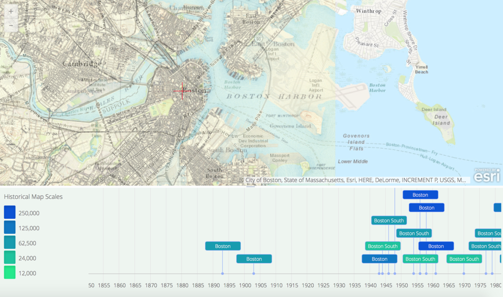
U.S. Geological Survey and Esri teamed up to create an interactive map that allows a user to overlay historical maps of Boston from 1893–1989 onto a current map of the city. Users can choose from 16 different maps spanning the century, and can overlay them, reorder them, and adjust map transparency as needed to answer their own questions about land use changes in the city. Take a look at how isolated Governors Island slowly evolved into Logan International Airport.
2. Potential Flooding in Boston

The Boston Globe worked with Dr. Ellen M. Douglas of UMass Boston and the Boston Harbor Association to create a straightforward interactive tool that exposes harbor flood risk in different sea level rise scenarios. Users can look at what flooding might look like if sea level is 2.5 feet higher than present day, 5 feet higher, or if there is 5 feet of storm surge with already heightened sea level. Be warned: there are only a handful of regions where one can seek refuge and keep dry feet. Every Bostonian should study this map.
3. Surging Seas Risk Zone Map

Created by Climate Central’s Program on Sea Level Rise, this interactive graphic may be the most comprehensive flood risk tool to date. Not only can users adjust future sea level rise from 1–10 feet, they can do so while comparing that flood risk to social vulnerability, population, ethnicity, income, property value, and landmarks such as museums, hospitals and power plants. With zoom functions and links to even more data and interactive graphics, this site is an incredible resource for residents and policymakers alike. Give yourself time to explore.
4. Boston, Massachusetts: Elevation And Population Density, 2010
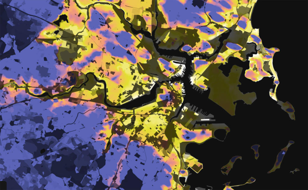
Data Pointed is a website filled with data visualizations by Stephen Von Worley. In this piece, Worley visualizes Boston topography and population density together in a simple static graphic. The brighter the color, the more residents per square mile. The warmer the color (e.g. yellow and white), the closer that area is to sea level. One can see that parts of Charlestown and East Boston almost glow. Though non-interactive, this visual strategy offers a quick perspective on population risk for flooding in low-lying areas.
5. Boston Living with Water competition finalists

Last summer, the City of Boston, The Boston Harbor Association, the Boston Redevelopment Authority and the Boston Society of Architects revealed the winners of their urban design competition that “sought design solutions envisioning a beautiful, vibrant, and resilient Boston that is prepared for end-of-the-century climate conditions and rising sea levels.” The three final designs, which each focused on a different type of site (a building, a neighborhood and a piece of city infrastructure), show viewers the creative breadth that is already informing how Boston will prepare for higher sea level in 2100. With suspension footbridges and integrated neighborhood tidal basins, proactive waterfront infrastructure and sustainable habitat restoration turn Boston’s future coasts from problem areas into urban opportunities.


